AFL Architects | Knells Farm, Paddock Wood
Press enter to search

Knells Farm, Paddock Wood

← Back to projects

The promotion of allocated sites in Tunbridge Wells, Kent, for circa 1500 – 1800 dwellings. A sustainable urban extension which forms part of the Council’s ambitions to deliver a total of 3,500 dwellings as part of a local housing strategic plan.

Located to the east of Paddock Wood and neighbouring an area of outstanding natural beauty, Knells Farm creates a distinctive interface between town and country within a high-quality, connective and unique setting.

Guided by in-house research and development on Garden Village principles

Our manifesto for redefining the Garden Community and creating a relevance for it in the modern day is subsequently driving the strategic design vision for the site.

Knells Farm represents a 21st-century interpretation of the concept’s benefits and opportunities.

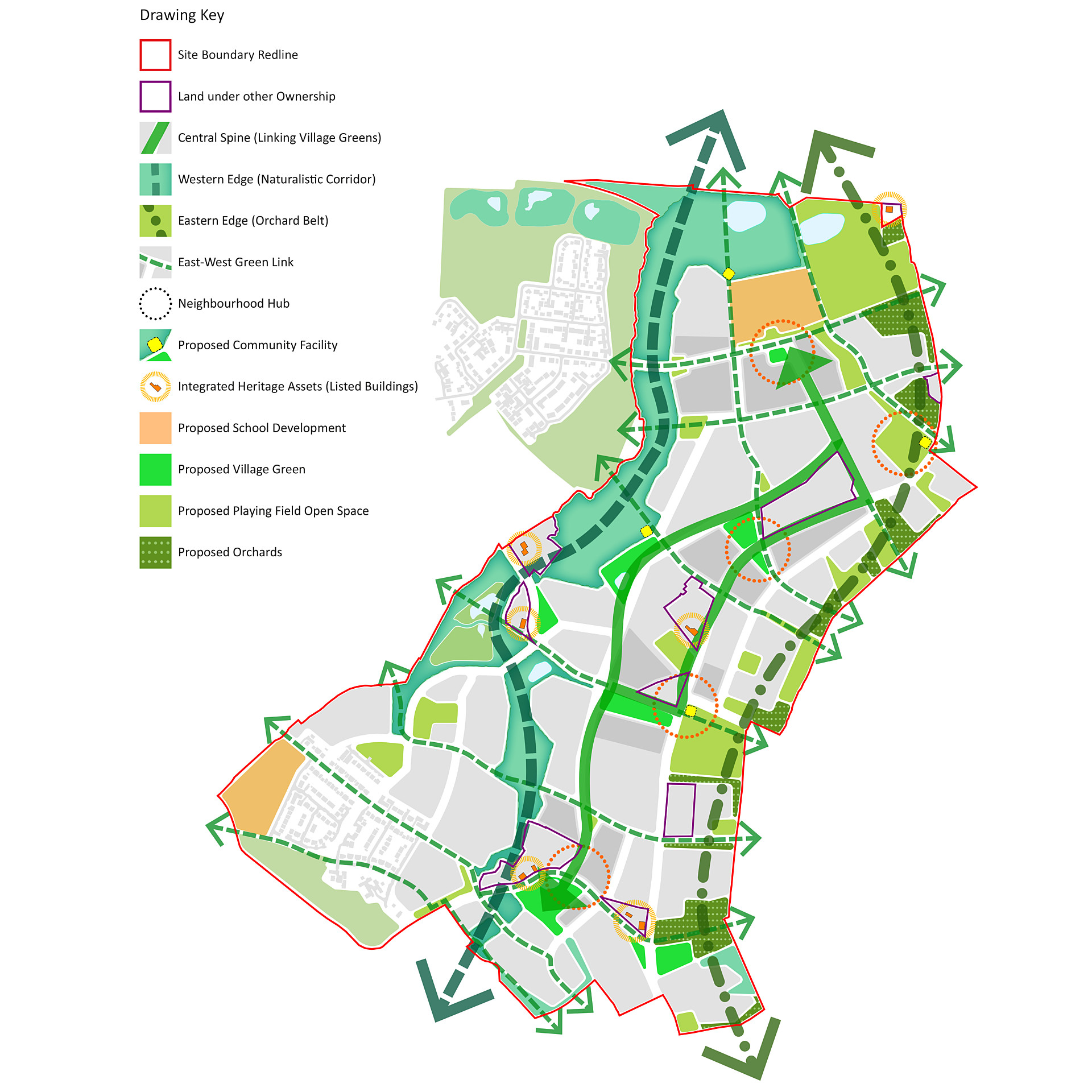
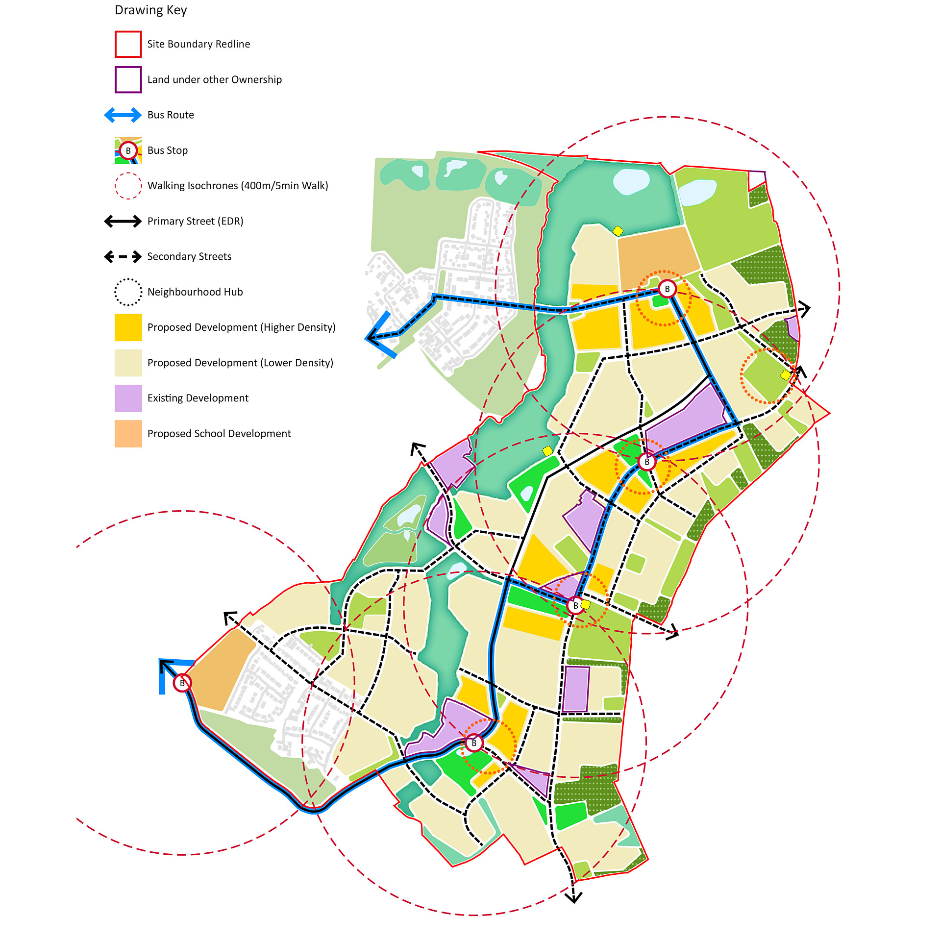
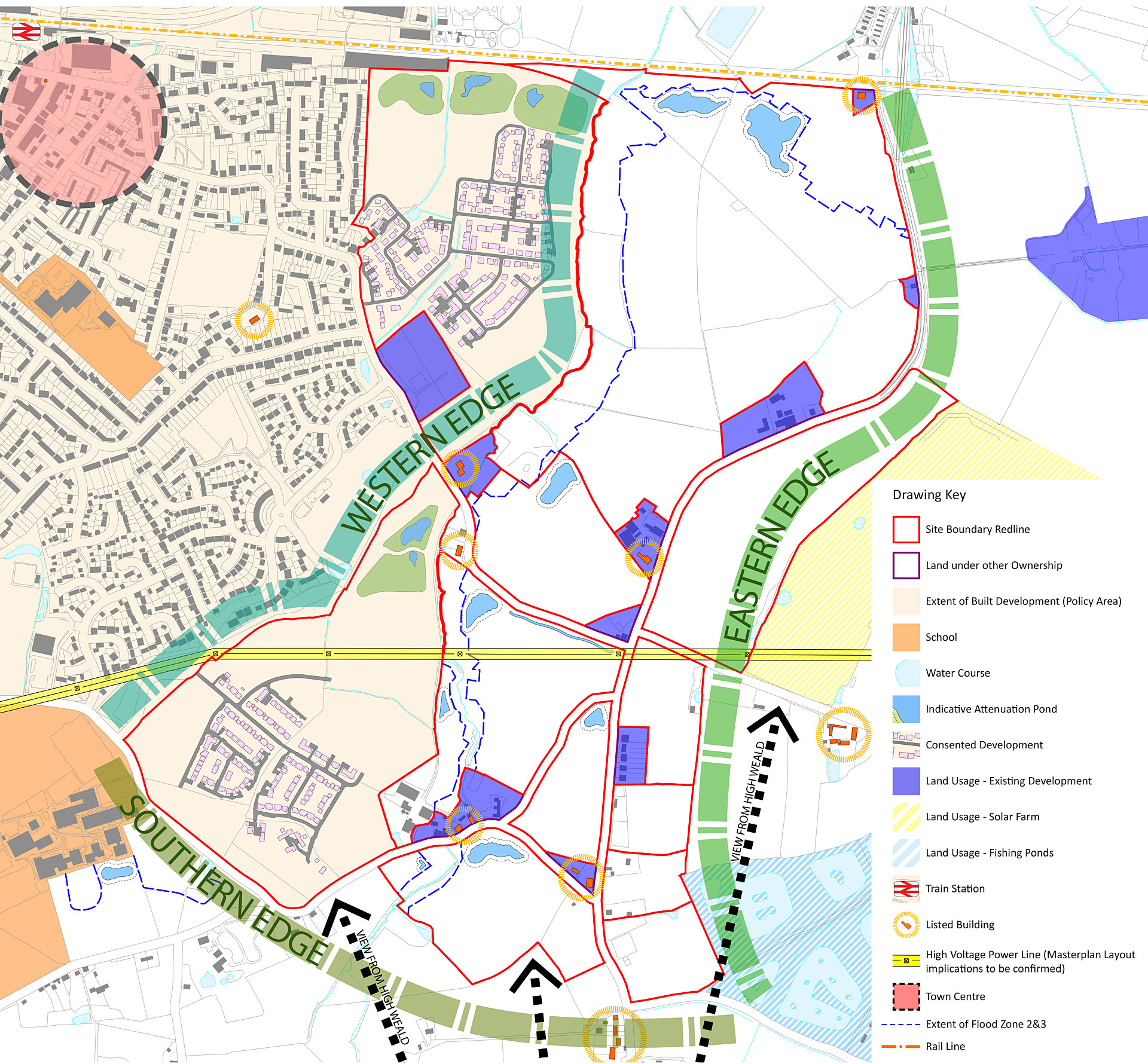
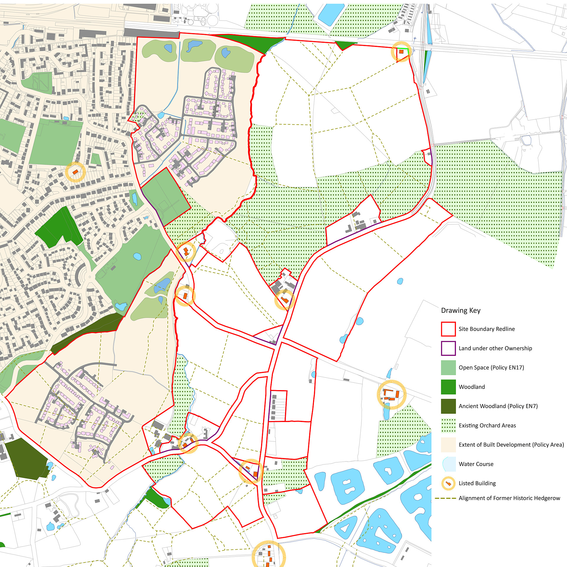
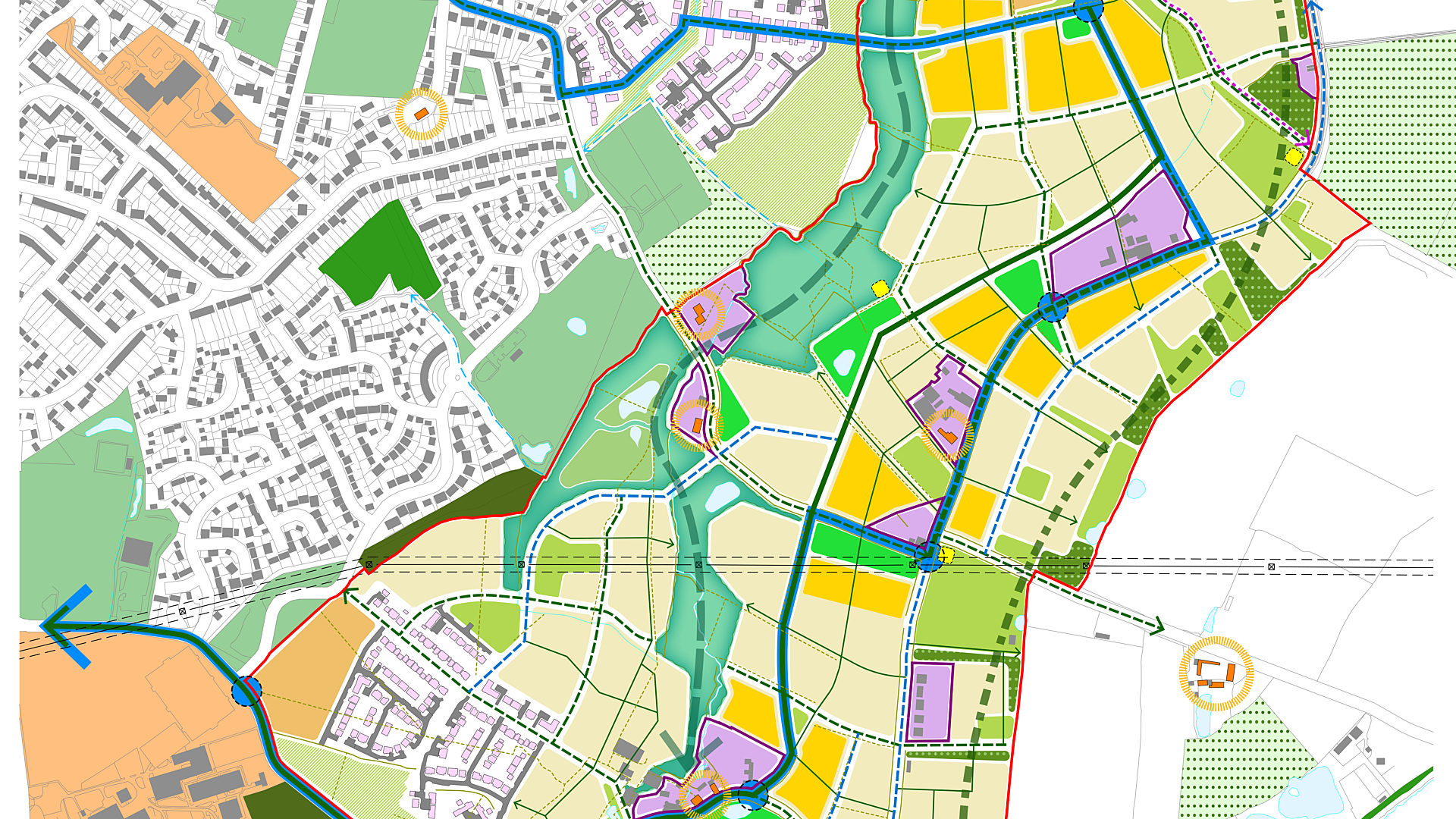
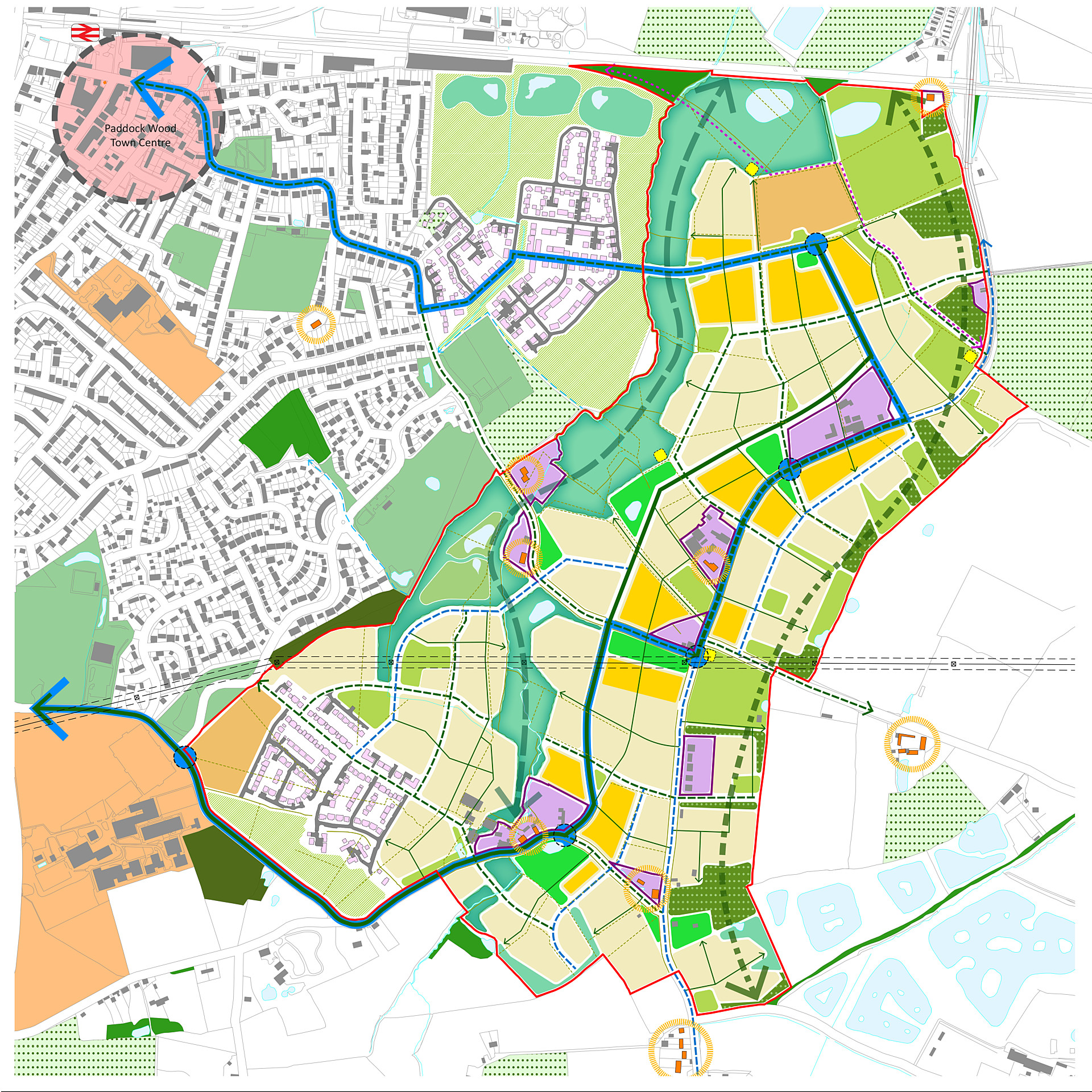
Sensitive incorporation of existing built and natural assets forms the basis of each neighbourhood character. A focus on greater connectivity will be achieved through a considered network of hierarchy of streets, routes, green links, public realm and transit systems.

The Garden Village principle of self-contained neighbourhoods has been retained and enhanced. Spaces for education, employment, recreational, leisure and community use are incorporated seamlessly within the masterplan structure. These spaces are informed by listed buildings, structures and farmstead building groups. These built assets have been explored within development proposals for their potential incorporation as local hubs.

Each development edge presents new challenges to be considered within the holistic vision

The masterplan explores and tests new movement patterns and linkages between the development to the west, its agrarian setting to the east and south and surrounding farmstead settlements contained within the study area.

On the western edge lies the existing town and existing stream corridor, offering connectivity and density challenges while retaining the development’s distinctiveness from Paddock Wood.

The eastern edge opens into countryside. This interface will incorporate adjacent agrarian and open space patterns and uses, ultimately enhancing views towards the site. Similarly, the southern edge has its own agricultural patterns and boundaries, plus more complex and fine-grained topography. Existing farmsteads and development pockets within the proposed masterplan site are integrated cohesively within the proposals.

Extensive natural assets gift the site with opportunities for landmark green and blue infrastructure

The site is situated between the foot slopes and ‘fruit belt’ of the High Weald landscape area and the flat arable pastureland of the Low Weald to the south and the Medway Valley.

The masterplan protects views into the neighbouring area of outstanding natural beauty, floodplain and field drainage patterns, historic rail alignments, listed structures and historic woodlands and orchards. In turn, they are enhanced for educational, agricultural and community use. The retention of woodland and an old hop pickers line creates new connections and retains the memory of the area’s agricultural heritage. Existing country lanes are reinforced to preclude hedgerow loss.

These landscape types are past determinants of both the evolution of natural systems and human patterns of development over time. Recognising and documenting their importance informs future masterplan design principles, promotes design quality and strengthens local distinctiveness.

Share

Related Projects